Great Whernside
| OS Map : | 98 |
| Start : | Kirkland Village |
| SD968723 | |
| 200 | |
| Park in the village. | |
| Summary : | Kettlewell - Hag Dyke - Great Whernside - Minor Road (Cattle Grid) - Cam Head - Kettlewell |
| distance : | 10.0km. |
| ascent : | 470m. |
| time : | 3hr. 50min. |
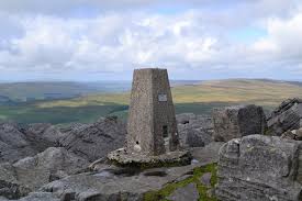
The summit of Great Whernside
walkingtheyorkshiredales.co.uk
Kettlewell
Current Weather
Last Updated today at : 3:41:06
| Overall : | overcast clouds |
| Temperature : | 8degC. |
| Wind Speed : | 23km/hr. |
| Wind Direction : | W |
| Clouds : | overcast clouds |
| Precipitation : | none |
| Sunrise : | 7:49:36 |
| Sunset : | 17:55:23 |
| (Times are BST) |
Data from openweathermap.org
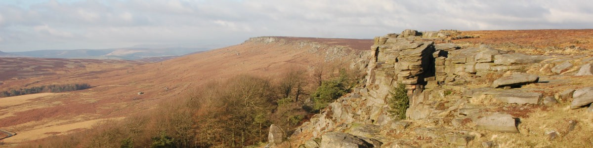
Great Whernside sits above the village of Kettlewell in the southern part of the Yorkshire Dales. An isolated but interesting hill. One peculiar feature is the minor road that climbs out of kettlewelland over to Coverdale crossing the col at some 500m. This could be an easy route up and down; but this route takes the hillwalker in a circular tour of the tops around Park Gill Beck. The summit is a trig point set amoungs the vast summit plateau. Great Whernside, not to be confused with Whernside sits above the viaalage of Keetlewell. This route follows the paths on the west of the hill amd makes for a great day walking.
Park in the village of Kettlewell and make your way east out out of the village
From the village make your way up Park Gill Beck and then turn lft on the path to Hay Tonge. Just after the track crosses a smll beck start the uphill climb by the obvious path. This takes the walker over hag Dyke and then directly to the trig point of Great Whernside. (3kms. 450m. 1hrs. 50min.)
Leave the summit in a northerly direction for around 1km. Here there is a path that descends to the minor raod. Follow this to the road and cattle grid. Cross the roadand follow the paths around the rocks and around to Cam Head. Now descend to the village via the good path that soon becomes a track all the way back to the village. (7kms. 20m. 2hrs. 10min.)
w : https://www.gritstoneedge.co.uk
e :
 My Blog
 gritstoneedge instagram
 gritstoneedge linktr.ee
Disclaimer :This site has links to many adventures in the outdoors, walking or cycling in hills and moors, within the UK. These can be dangerous activities. Conditions can change rapidly in the outdoors. The information and links provided on this site is given in good faith. gritstoneedge.co.uk cannot be held responsible for any loss or injury caused by encouraging you into the outdoors of by the accuracy of the information provided on this site.
© gritstoneedge.co.uk all rights reserved 2015-2025